Charter fishing in Colorado


Adventure Colorado Guide Service
Charter fishing in Colorado
We are continuously adding new lakes and destinations across the state !
No Longer in Business
Due to Covid
Large Mouth
Rainbow
Carter Lake
Current Weather Conditions - Maps
10 Day Weather Forecast ( barometric pressure - wind - temperature )

Splake
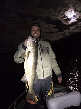
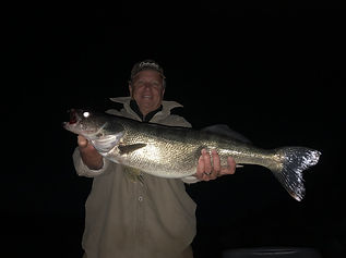
Walleye

Carter Lake Reservoir, has a water surface of 1,100 acres, about eight miles of shoreline, more than 900 acres of surrounding public land, and a capacity of 112,230 acre-feet.
Carter Lake is known for it's trophy walleyes, largemouth bass, rainbow, cutthroat, splake, occasional brown trout, and yellow perch.
The earthen dam was completed in 1950 by the United States Bureau of Reclamation, with a height of 214 feet, and a length of 1235 at its crest. At 5,760 feet in elevation, it is nestled in the foothills southwest of Loveland, Colorado, and northwest of Berthoud, Colorado.
Location: Larimer county. Go 5 miles W of Loveland on HWY 34, then S 2 miles on CR 29, then W 2 miles of CR 18E then follow signage.
Carter Lake - Berthoud CO
Carter Lake Regulations:
Walleye: Daily limit of 3 total (must be less than 21" or else immediately returned to the water)
Bass: Daily limit of 5 total (must be over 15" or else immediately returned to the water)
Trout: Daily statewide limit of 4 total (no size restriction)
Carter Lake requires a daily entrance permit and they are available via self-serve stations. Carter Lake is open year round.

Directions to Carter Lake
From Denver:
-
Take I-25 North to the Berthoud Exit (Exit 250).
-
Turn left (west) onto Highway 56 and continue for 9 1/2 miles. (You will pass through the town of Berthoud.)
-
Watch for the Carter Lake road sign after a sharp curve to the north (right).
-
Turn left (west) onto County Road 8E and continue for 3 miles.
-
Stop at the entrance station to purchase Park Entrance Permits, Follow County Road 8E west to the intersection about halfway up the hill. A sign will direct you to continue straight to the South Shore Campground or to turn right to Carter Knolls Campground, the swim beach, Big Thompson Campground, Carter Lake Marina, Eagle Campground, Lowell's Campground and North Pines Campground. The Natural Resources Department is located about 2 miles north of Carter Lake at 1800 South County Road 31.
From Longmont or Boulder:
-
Take U.S. Highway 287 north to County Road 56 west of Berthoud.
-
Turn left (west) onto County Road 56.
Follow direction from # 3 above
From Loveland:
-
Drive west of Loveland on U.S. Highway 34 to mile marker #85. Watch for the "Carter Lake" sign.
-
Turn left (south) onto County Road 29. Go 2 miles and turn right (west) onto County Road 18E. Go west another 2 miles. Watch for the park signs.
-
At County Road 31 turn left and stop to purchase park entrance permits at the entrance station on your right or at The Natural Resources Department. Continue south on County Road 31 another 2 miles to Carter Lake, campgrounds, marina, and swim beach.
From Fort Collins:
-
Take Taft Hill Road south from Fort Collins to U.S. Highway 34 (Eisenhower) in Loveland and turn right (west).
Follow directions from Loveland above.